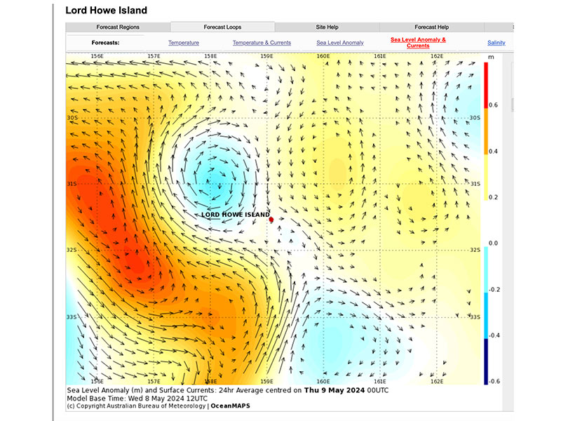
During the week ending the 10th of May, Lord Howe Island experienced extremely low tides – tens of centimetres lower than the published tidal predictions, which are based on calculations of astronomical movements of the sun and moon around the earth, creating gravitational pull on the world’s oceans. This variation from the predicted tide level is caused by a sea level anomaly.
The sea surface is a dynamic mixture of bumps and dips resulting from a variety of factors, including gravity, ocean currents, ocean temperature, ocean salinity, wind patterns, high-pressure weather systems, and the rotation of the Earth. Sometimes, several factors combine to heap water in some areas of the ocean higher than normal. At other times factors may work together to lower the sea level.
Scientists study variations in sea surface height using radar altimeters on satellites. These altimeters emit radar pulses that bounce off the ocean’s surface and are detected by a sensor on the satellite when they return. Sea surface height derived from satellite altimeters is accurate to within about 3-4 centimetres.
Anomalies in sea level can be identified by calculating the difference between the measured sea surface height and the average sea surface height. This combination during that week of May 10th, with a New Moon gravity pull (alignment of the sun and moon exerting greatest gravitational pull on the ocean water), and other factors in the Tasman Sea, created low tides that exposed much of the coral in the Lagoon.
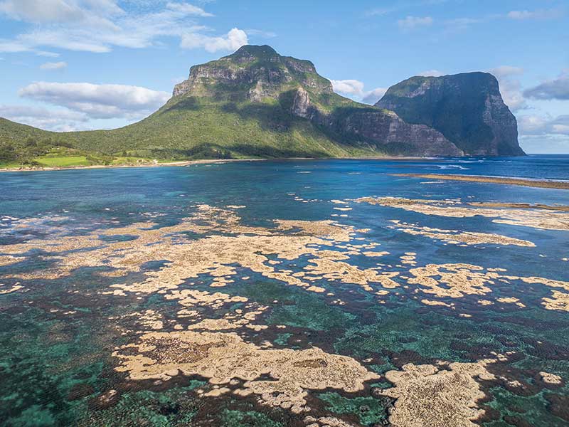
Many Island residents took the opportunity to explore areas not usually accessible by foot. Unfortunately, the extreme exposure of coral, with upper layers exposed to air and completely drying out, will aggravate coral bleaching in 2024.
Note: In February, we had a high sea level anomaly around us, and the sea level was about 50 cm higher than predicted, and this probably saved the coral from more severe bleaching than could have been experienced. The tide was not as low, and this protected the coral to a certain extent.
Here is the sea level anomaly map produced by the Bureau of Meteorology for 9 May, 2024. You can view daily on this link.